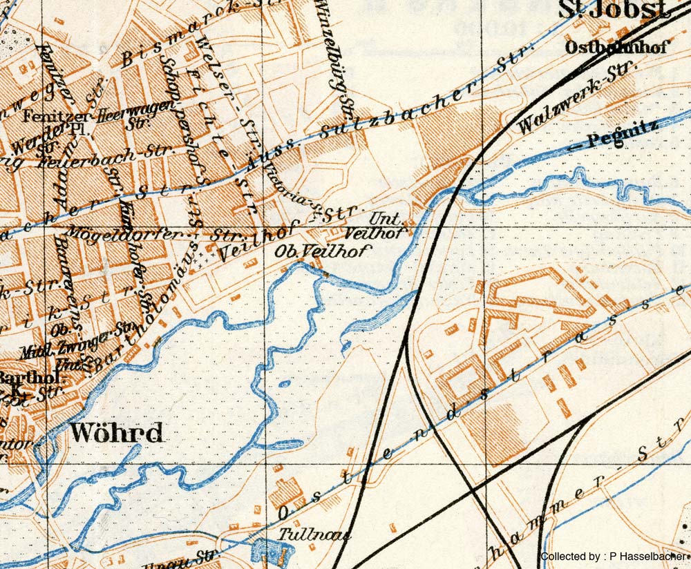
Below is a wider detail from the 1929 map of Nürnberg and Wöhrd. On the southern side of Veilhofstraße is the old building standing today that houses an old-folks home. Note the labels "Ob[er] Veilhof" and Unt[er] Veilhof (upper and lower). These refer to the locations of an ancient manor house and farm-holding (bauerngut) respectively. The modern kindergarden is in the area once known as Untervielhof. The original location of Oberveilhof is the rectangulatr building just below the 'ei' in Vielhofstrasse, and my father was born at the 'o'. I will say more about this old history elsewhere.
Overlay of Old and New Wöhrd Bridges
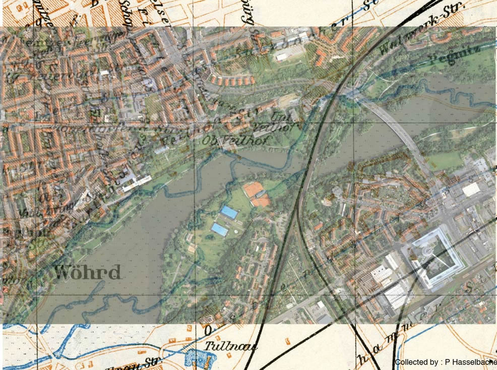
I lined up the old map above with a modern Google Map satellite view. The alignment is closest in the area of the railroad bridge and kindergarden. It gives a sense of where the old river flowed compared to the modern See. The area of the northern channel of the river was filled in as the lake area was excavated.
Where the Wöhrder See is today was a large meadow that my Grandfather and his brother and sister played as children at the turn of the Century, and where my father Franz would have played as a boy before 1925.