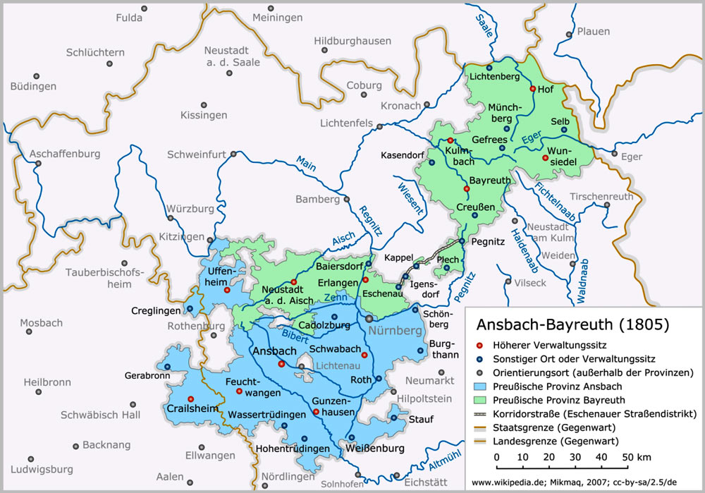
These were the lands ruled over by the Margrave od Anabach-Bayreuth of the time. I do not know what to call the domain of a Margrave, so I will just use "Kingdom" for the time being. You can see that the lands are in two parts connected by a Korridorstraße.
In the north-eastern portion lies the city of Bayreuth that lends its name to the entire green region, In the south-western region lies the city of Ansbach for which the entire region in blue is named. Neustadt lies 40 kilometers north of Ansbach on the river Aisch. Münchsteinach lies just 9 kilometers north of Neustadt.
The red dots signify larger or more important administrative towns or centers.
The free city of Nürnberg lies on the border between the two districts of Ansbach and Bayreuth.
Peter Hasselbacher, December 3, 2012